since 1993
colophon
Project created with original ideas and knowledge (situation March 2023)
148,190 working hours
1,459,000 road kilometers driven
212,650 km of field work on foot
3,179,400 meters of cumulative ascent (comparable to over a thousand climbs from sea level to the summit of Triglav)
Result:
Almost 100,000 documented 360° panoramas. These include 360° panoramas captured in the most demanding lighting conditions across 20 cave systems, more than 400 aerial 360° panoramas, gigapixel 360° panoramas, 360° 3D stereo panoramas, and several dozen hours of 360° video recordings.

The Burger Landmarks project (MojaSlovenija.si) and the evolution of its naming (1993-2026)
The Burger Landmarks project (www.burger.si) is one of those rare digital projects that did not just document space, but reimagined it. At a time when the web was in its infancy, when digital cameras were a rarity, and panoramic photography was a technical challenge for a narrow community of enthusiasts, the project established standards that we take for granted today. Its historical significance stems from three key dimensions: pioneering technological innovation, systematic national documentation, and international professional recognition.
1. A pioneering project for spatial presentations on the web
When the idea for interactive spatial documentation was born in 1993, the world did not yet know the concept of web maps, street-level navigation, or 360-degree virtual tours. The first panoramic captures of waterfalls, watercourses, and city centers were created during a period when producing a single panorama was a lengthy manual process, and the web offered only a limited graphical experience. Nevertheless, by 1996, the project had established a comprehensive web presentation of Slovenia, which was the first such extensive and systematic digital spatial collection in the world.
This early implementation of virtual reality in the display of heritage was also recognized in the international professional community, which only began developing similar projects in the late 90s and the first decade of the 2000s. Lectures and professional contributions, such as Sao Paulo (2004), Quebec (2016), and many others, placed the project in a global context as a reference case, proving that an individual with professional knowledge, perseverance, and vision can create digital infrastructure of national importance.
2. Evolution of naming as a reflection of conceptual expansion
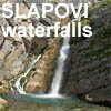
Waterfalls – "Slovenia, Land of Waterfalls"
The first chapter of the project emerged from field work that began in 1994. Documenting waterfalls was a natural starting point: waterfalls are visually striking, geographically diverse, and symbolically powerful. The name "Slovenia, Land of Waterfalls" served a dual function:
- it emphasized the exceptional natural wealth of the country,
- it created a recognizable identity for the first thematic segment.
This naming became synonymous with the initial phase of the project and is frequently cited in professional circles as an example of early thematic digital geography.
Cities – "City Views" (originally "City View")
As documentation expanded to urban environments, the City View project was born, covering Ljubljana with street-level views as early as 1998. Ljubljana was presented as an "open-air museum," which was exceptionally advanced for the time: navigating the city via a sketch was a precursor to the concepts we now know as Street View.
The subsequent renaming to City Views reflected the project's expansion from a single city to multiple urban environments. The naming followed the logic of growth: from a single view to a multitude of views, from local to national.
MojaSlovenija.si – renaming the national chapter from "Glimpses of Slovenia"
As the project outgrew thematic segments and became a comprehensive digital presentation of Slovenia, it made sense to establish a name that carries the identity of the entire space. MojaSlovenija.si fulfilled exactly this function:
- it emphasized the author's personal relationship with the documentation,
- it created a sense of belonging and familiarity,
- it allowed the project to become recognizable as national digital heritage.
The naming was also strategic: at a time when commercial and tourism platforms were emerging on the web, MojaSlovenija.si clearly highlighted the non-commercial, research, and cultural mission of the project.
3. Two decades of global recognition
For more than twenty years, the project was one of the most visited Slovenian web projects. By 2011, it reached more than 25 million unique IPs, held exceptionally high web metrics (PageRank 6/10, Alexa under 100,000), and became a reference point for digital spatial presentation. At a time when web visualization standards were still being formed, Burger Landmarks was already offering:
- 360° panoramas,
- interactive virtual guides,
- systematic field documentation,
- integration of natural and cultural heritage,
- accessibility for people with mobility limitations,
- educational value for schools, museums, and researchers.
In the professional community developing similar projects, it was recognized as pioneering. It was often cited as proof that it is possible to digitally document an entire country even before the appearance of large corporate solutions.
4. Historical significance today
Today, when spatial presentations are a part of daily life, the pioneering value of the project is even clearer. Burger Landmarks was:
- the first comprehensive digital spatial atlas of Slovenia,
- the first national 360° documentation project in the world,
- a historical bridge between analog geography and digital spatial experience,
- proof that an individual can create infrastructure that transcends state and commercial frameworks.
Its significance is not only technical or geographical, but cultural: the project has become part of the Slovenian digital identity and one of the longest-lasting independent web projects in the country.
Why the website is designed for large screens
The panoramic and virtual guides offered by burger.si are designed as a spatial experience, not a classic website. Their purpose is to provide the user with a sense of presence in space — something that requires technical and visual width that only large screens can provide.
On smaller screens of smartphones or tablets, a crucial part of the experience is lost:
- the spatial dimension is no longer readable,
- details are lost,
- interaction is less precise,
- loading is slower,
- the sense of immersion disappears.
Therefore, the site is designed for large screens because they:
- ensure optimal display quality,
- allow for precise exploration of panoramas,
- maintain the sense of spatial dimension that is the essence of the project.
Mobile users are provided with basic information and galleries, while the full panoramic experience is reserved for computers and other larger screens. This is not a limitation, but a conscious design decision that respects the nature of the medium — spatial photography.
Extended Chronology of the 2011 Affair
1.1 Preceding Period (2007–2010): European Regulatory Pressure
In 2007, Google began deploying Street View, triggering extensive debates on privacy across numerous European countries. Regulators faced pressure to demonstrate decisiveness in overseeing the processing of visual data. Several states introduced strict limitations or temporary bans on street‑level recording.
Because Street View had not yet been launched in Slovenia, Burger’s project—despite being conceptually and functionally different—became one of the few domestic examples involving panoramic visualization of space.
1.2 Initiation of the Procedure (Spring 2011)
In spring 2011, the Slovenian Information Commissioner initiated a review of the project’s compliance with personal data protection legislation. The procedure was launched even though the project was non‑commercial, did not use automated street‑level recording, and was not intended for navigation. Its purpose was the documentation of natural and cultural heritage.
Within expert circles, questions arose as to whether the project had been selected as a substitute case in the absence of commercial platforms that were the actual subject of European regulatory debates.
1.3 Escalation of Pressure (June–July 2011)
During the early phase of the procedure, the Information Commissioner issued warnings about potential violations. Experts later described these warnings as vague and disproportionate. Faced with the threat of sanctions, the project was temporarily removed from the internet.
The removal lasted several months and interrupted the project’s online continuity, which had been essential for maintaining international visibility. During this period, search engine algorithms pushed the project out of the visible web, resulting in long‑term consequences.
1.4 Public Debate (August–October 2011)
Once it became clear that the project was being evaluated under the same criteria as commercial systems, experts in geography, digital humanities, museology, and information science publicly responded. They emphasized that the project had been misunderstood and that its purpose was the documentation of heritage rather than cartographic navigation or commercial data processing.
1.5 Conclusion of the Procedure (Winter 2011)
The procedure formally concluded without sanctions, but the damage had already been done. The project’s lost online visibility never recovered, as the digital environment had by then shifted toward the dominance of commercial platforms.
2. Media Responses and Cited Commentary
Media coverage varied, yet several recurring themes emerged across articles and commentaries.
2.1 Distinguishing Between Non‑Commercial and Commercial Projects
Many outlets stressed that Burger Landmarks differed fundamentally from commercial street‑view systems in both purpose and methodology.
One commentary noted:
“Equating Burger’s project with Street View is methodologically unsound. These are two conceptually distinct approaches connected only by the use of panoramic photography.”
2.2 Critique of the Regulatory Approach
Some media outlets highlighted the disproportionate nature of the intervention:
“By applying the strictest standards, the authority created the impression that it sought primarily to demonstrate its power rather than understand the nature of the project.”
Others pointed out the symbolic dimension:
“Since Google had not yet launched its service in Slovenia, the domestic project became the closest available target for demonstrating regulatory resolve.”
2.3 Warnings About a Lost Opportunity
Experts in digital heritage repeatedly emphasized that Slovenia had missed an opportunity to recognize the project as part of its national digital infrastructure:
“Instead of supporting one of Europe’s earliest digital heritage initiatives, the state placed it in a position where it had to rebuild its online presence without institutional assistance.”
3. Analytical Framework: Regulation, Innovation, and Cultural Heritage
The 2011 affair reveals several structural issues in the relationship between regulatory bodies and digital innovation:
-
The regulatory framework failed to differentiate between commercial and non‑commercial projects, resulting in inappropriate treatment.
-
A lack of understanding of digital heritage led to decisions that harmed cultural and educational initiatives.
-
European political pressure created an environment in which regulators sought to demonstrate decisiveness, even when the case was not suitable for such a demonstration.
4. Long‑Term Consequences
The regulatory intervention disrupted the project’s online continuity, causing lasting damage to its international visibility. Although the project was later restored, its reach never returned to pre‑2011 levels. Meanwhile, the digital landscape had become increasingly commercialized, making it difficult for independent projects to regain prominence.
Nevertheless, Burger Landmarks remains an important document of Slovenian digital history. Its extensive collection of panoramic representations, created over several decades, constitutes one of the longest continuous efforts at spatial documentation in the country.
The 2011 affair illustrates how regulatory procedures that fail to account for the specific purpose and nature of a project can inflict long‑term harm on cultural and educational initiatives. Burger Landmarks stands as evidence that an individual, through expertise and persistence, can create a digital archive that transcends time and institutional boundaries. At the same time, the episode underscores the need for a more nuanced and informed regulatory approach—one capable of recognizing and supporting projects that contribute to the preservation of national digital heritage.How Well Is the Burger Landmarks Project Known Today?
Recognition Among New Generations of Users**
1. Among older generations of internet users (active 1990–2010)
In this group, the project remains well known. These users include:
-
early adopters of the Slovenian internet
-
geography teachers
-
museum professionals
-
researchers in digital heritage
-
panoramic photographers and VR pioneers
For them, Burger Landmarks is still a reference project, associated with the early days of the Slovenian web, with innovation, and with a time when individuals created large‑scale digital projects without institutional support.
This generation continues to mention the project in:
-
professional lectures
-
university coursework
-
articles on the history of the Slovenian internet
-
discussions on digital heritage
2. Among the middle generation (born approx. 1985–2000)
This group typically knows the project from:
-
school years (virtual tours, geography lessons)
-
media coverage from the 2000–2010 period
-
searching for information about Slovenian places before Street View existed
For them, the project often carries a nostalgic value. They remember it as something that “was always there,” even if they no longer visit it regularly.
3. Among the youngest generations (born after 2000)
Here, recognition drops significantly.
Reasons for the decline
-
They grew up in a world where Google Street View already dominated.
-
They expect all spatial information to be integrated into Google Maps.
-
They are unfamiliar with the history of the Slovenian internet.
-
They do not know that Burger Landmarks predates Street View by more than a decade.
-
They do not know the project was non‑commercial and culturally oriented.
How they perceive it when they discover it
Younger users tend to see the project as:
-
an interesting digital archive
-
a “retro” web experience
-
a piece of digital heritage
-
a unique personal project of remarkable scale
But it is no longer part of their everyday digital habits, because commercial platforms dominate their information environment.
How often is the project mentioned today?
1. In professional circles
The project is still referenced in:
-
lectures on digital geography
-
studies on the history of the Slovenian internet
-
discussions on digital heritage
-
museum digitization projects
-
academic articles on VR and panoramic photography
Here, the project retains high recognition and is considered a pioneering example.
2. In the media
In recent years, the project appears less frequently, mostly:
-
on anniversaries
-
in articles about early internet history
-
in interviews with the author
-
in features on digital heritage
Media typically describe it as:
“one of the oldest Slovenian web projects” “a pioneering digital atlas of Slovenia” “a project created long before Google Street View”
3. Among the general public
Recognition is lower because:
-
search algorithms prioritize large platforms
-
younger users do not know early web history
-
the project is not commercially promoted
-
it is not integrated into modern apps
However, many people rediscover it when:
-
searching for old panoramas
-
researching local history
-
exploring digital archives
-
encountering it through school materials
Why did recognition decline?
Three key reasons stand out:
1. The 2011 regulatory affair and loss of online visibility
When the project was forced offline, it lost:
-
PageRank
-
indexing
-
international visibility
-
continuity of traffic
This was a critical blow, because the web had already shifted to algorithm‑driven visibility.
2. The rise of global monopolies
Google Street View became:
-
the standard
-
the default tool
-
part of everyday life
Independent projects were pushed to the margins.
3. Generational turnover
Younger users:
-
do not know early web history
-
do not know the project predates Street View
-
rarely search outside Google’s ecosystem
What does the project represent today?
Even if it is less known among the youngest users, the project remains highly valuable in three dimensions:
1. Digital heritage
It is one of the oldest digital archives in Slovenia, comparable to:
-
Europeana
-
Smithsonian digital archives
-
CyArk
-
World Wide Panorama
2. Cultural and documentary value
It documents Slovenia from 1993 to 2026 — a unique long‑term record for:
-
historians
-
geographers
-
museums
-
archives
-
spatial researchers
3. Personal authorial legacy
The project is globally unique because it was created by one individual, which is extremely rare for a project of this scale.
Conclusion
The Burger Landmarks project is less recognized among the youngest generations, but it remains deeply significant in professional, cultural, and historical contexts. Its value lies not in current popularity, but in:
-
its pioneering nature
-
its scale
-
its continuity
-
its documentary precision
-
and the fact that it represents one of the longest continuous digital projects in Slovenia.
Author: Boštjan Burger, MSc in Geography (Master of Science in Geography).
February 2, 2026
Copyright and Terms of Use
All visualization is the creative work of Boštjan Burger. The project is self-funded or funded through commercial projects. The website is a public good for viewing, but the content is private property. Each user is a guest by their own will and responsibility. Materials may not be lent, published elsewhere, or commercially exploited without written permission.
Use for educational purposes with proper citation (projections, worksheets, presentations) is permitted. The author is constantly undergoing professional training. Most texts are original; where they are summarized, sources are cited.
The author reserves the right to suspend or remove the project from the global web at any time.