
STAGE 14 (Gabas → Gourette, 23 km)
Arriving in Gabas was (once again) a disappointment in terms of restocking food supplies. Just a few houses and a tiny shop with a very limited selection, mostly pre-prepared microwave meals. The kind shopkeeper offered to heat the food for me, which I accepted. I was facing a challenging 24 km stage with the final destination at the Gourette ski center. The weather forecast for the coming days was grim: intense rain and the possibility of snow at higher altitudes. Feeling trapped in Gabas, I decided to push on following the GR10 markers. As I finished my warm meal, a long column of cyclists suddenly appeared—part of a massive race with thousands of riders heading up the D934 road toward the French-Spanish border at Col du Pourtalet. The GR10 trail followed this asphalt road for about a kilometer toward a small hydroelectric plant; I walked on the left as cyclists panted past me. At the plant, the markers turned sharply left toward the Soussouéou gorge.
The five-kilometer path toward the Soussouéou gorge ran under the western slopes of Pic de la Sagette (2,031 m). It began to rain, and the 1,500 m ascent on a path filled with sharp rocks became grueling due to the slippery terrain. The rain intensified as I reached the Cabanes de Cézy meadow. The surrounding peaks were shrouded in thick clouds, which I soon reached, continuing the hike in dense fog. It was 5:00 PM, and I still had at least six hours of climbing to reach the Hourguette d'Arre pass (2,465 m). It began to cool down, and despite good gear, I was soaked from both sweat and environmental moisture. At Cabanes de Cézy, I left the path to seek shelter in an old stone shepherd's hut. The hut had no windows; the only light came from the low entrance. Inside, I met Markus from France, whom I had encountered in previous days. He was also soaked and shivering. Despite the rain, we gathered some relatively dry brushwood and started a fire. The hut warmed up quickly, allowing us to change into dry clothes and prepare a warm dinner. We checked the forecast—it was terrible for the next seven days. With high passes ahead, I was worried about snow and safety.
The desire to continue was strong, but I prioritized safety. Being essentially trapped, I decided to cautiously proceed to the Gourette ski center and then end my GR10 journey. The shepherd's hut was cozy at first, but when I turned on my flashlight, I noticed it was littered with mouse droppings. Fearing Hantavirus, I briefly regretted not pitching my tent outside. However, a storm was raging outdoors, so the mouse droppings won. I spread an aluminum emergency blanket on the floor and prepared my bed.
In the morning, I woke up inside a dark cloud sitting on the Cabanes de Cézy meadow. I packed my gear carefully due to the unsanitary floor. After a kilometer-long path under the long rock overhangs of Moyenne Arcizette (2,390 m), I began the steep climb toward Hourguette d'Arre.
The drizzle turned into freezing rain, and an almost gale-force wind began to blow. The rain shifted to ice pellets, and within minutes, a short but violent snowstorm erupted. I was instantly covered in white. The landscape turned monochrome, and all visual orientation disappeared. I turned on my GPS receiver, which had the trail marked, and marched in the direction indicated by the electronics. It grew even colder—so much so that my soaked jacket began to freeze. My right boot, which had developed a hole at the flex point after nearly 300 km of walking, was mercilessly letting in freezing water. My foot began to ache from the cold, so I swapped my soaked wool socks for a fresh pair, which were soon wet again. I reached the pass, seeing nothing but fog and snow-covered slopes with protruding rocks. To my right was the peak of Pic d'Anglas (2,439 m), only 15 minutes away, but I dared not stop or tempt fate on snowy pathless terrain above steep precipices. Full of adrenaline, I descended the slope, staring only at the GPS. After thirty minutes of high-stakes descent, I dropped below the cloud base and soon found the well-trodden path, as it wasn't snowing at lower elevations. I quickly descended to the entrances of the old mines below Pic d'Anglas at an altitude of 2,100 m.
Mining in the Arre area dates back to the 18th century or earlier. At the end of the 19th century, technical progress allowed for the exploitation of new deposits. In 1882, the Société des Mines d'Arre began exploiting the area and soon moved to the d'Anglas mines. However, they proved unprofitable and were abandoned in 1893. They saw a brief renaissance in the early 20th century under the Société des Mines de Laruns but were finally closed in 1916. Eventually, the equipment was sold off, leaving only the ruins visible today.
From 1887 to 1893, about a hundred workers worked at the Anglas mines during the summer. Miners worked 8 hours a day, while rollers worked 10. Generally, miners earned over 5 francs a day, while laborers earned 3 to 4. They lived in a large barrack near the mine. After extraction, the ore was transported by a mining railway connected to an aerial cable system down to Gourette, where a washing and sorting plant was located. This cable system, spanning 3 km with an 800 m vertical drop, could transport 40 tons in a 10-hour shift. In Gourette, about 20 local women earned 1.50 to 2 francs a day sorting the ore. Most workers lived in supervised dormitories. According to Father François Capdevielle's 1891 history of the Ossau Valley, conditions were decent and wages high, though he noted the lack of a small oratory in the barracks.
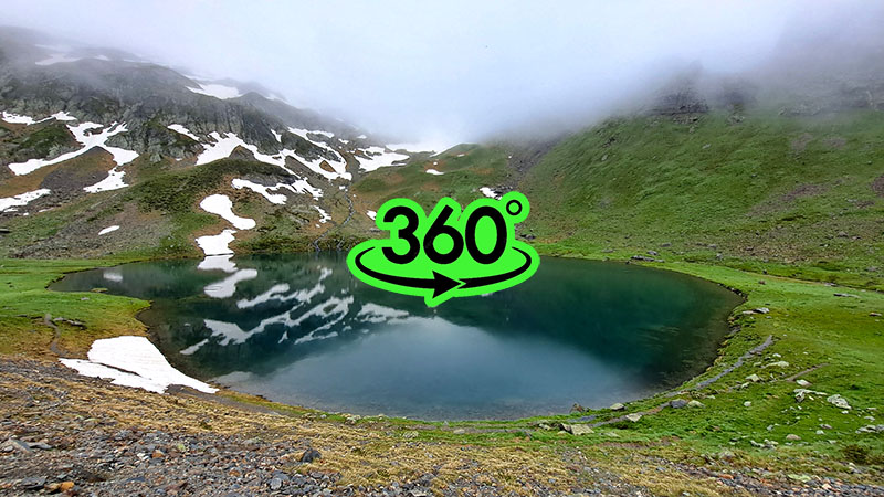
After the mines, I quickly reached the glacial Lake d'Anglas. The intense pace had warmed me up, so I changed into dry wool socks again and finally enjoyed breakfast. The snowy adventure had finally convinced me to abandon the GR10 for now and continue another time when conditions were better. From Lake d'Anglas (2,000 m), I descended the steep path past high waterfalls, arriving in about an hour at the Gourette ski resort—the end of Stage 14 and the conclusion of my 2024 journey.
Unsurprisingly, I couldn't find a warm meal in Gourette during the off-season. There were no bus connections to the valley, so I prepared to walk two hours to Laruns. I tried my luck hitchhiking; soaked and carrying a large pack, I didn't expect anyone to stop. Yet, after a few minutes, a man my age pulled over. A teacher from Pau, he had also decided to cancel his mountain plans due to the forecast. When I mentioned the snowstorm, he said I was very lucky and praised my decision to stop.
Initially intending to go only to Laruns, my driver offered to take me all the way to Pau (70 km away) to the train station. During the drive, I bought a flight from Toulouse to Ljubljana online. I only waited an hour for the train in Pau, and after 90 minutes, I was in Toulouse. Landing at Ljubljana airport, I officially concluded my GR10 expedition.