 |
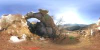
#01
naravni most
natural bridge |
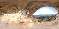 |
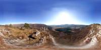
#02
spodmol
rock shelter |
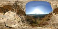 |
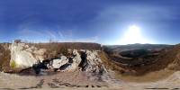
#03
spodmol
rock shelter |
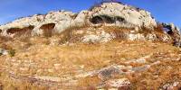 |
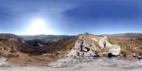
#04
spodmoli - panorama
rock shelters - panorama |
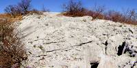 |
#05
Veli Badin (412 m) - erozija
erosion
lat: 45° 27' 40'' N / lon: 13° 54' 42'' E (WGS 84) |
 |
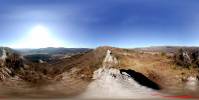
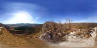
#06
Veli Badin (361 m) - panorama
lat: 45° 27' 34'' N / lon: 13° 54' 49'' E |
 |
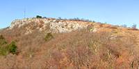
#07
Veli Badin (332 m) - vrh naravne 'skulpture'
top of the natural sculpture
lat: 45° 27' 30'' N / lon: 13° 55' 04'' E |
 |
#08
Veli Badin (325 m) - 'Velikonočni otok' (pod skulpturo)
'Easter island' - below the sculpture
lat: 45° 27' 28'' N / lon: 13° 55' 03'' E |
 |
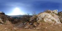
#09
Veli Badin (326 m)- panorama
lat: 45° 27' 28'' N / lon: 13° 55' 07'' E |
 |
#10
Veli Badin (270 m)
lat: 45° 27' 22'' N / lon: 13° 55' 19'' E |
 |
#11
Veli Badin - vrh pečine (359 m)
Top of the cliff (359 m) |
 |
#12
Veli Badin - pogled na spodmole od zgoraj
vista to rock shelters from the top |